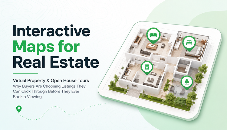
Interactive Maps for Real Estate: Virtual Property & Open House Tours
Why Buyers Are Choosing Listings They Can Click Through Before They Ever Book a Viewing
A buyer in Toronto scrolls through forty listing photos on a Tuesday night, still can't tell how the backyard connects to the garage, and closes the tab. That's the moment most real estate marketing quietly fails, not because the photos were bad, but because a photo gallery was never built to answer "How does this actually flow?"
Interactive maps for real estate solve that specific problem. Instead of forcing a buyer to mentally stitch together twenty static images, an interactive map lets them click through the property the way they'd actually walk it room by room, building by building, or across an entire development.
Interactive maps for real estate are clickable, zoomable digital layouts of a property or development that let buyers explore room locations, amenities, floor plans, and surroundings from any device before, during, or after an open house. Agents embed them directly on listing pages, share them as a link, or print a QR code that visitors scan on-site for a self-guided tour.
What Interactive Maps for Real Estate Actually Are
An interactive property map isn't a single photo with hotspots; it's a full digital layout of a space that a viewer can navigate. For a single home, that might mean a floor plan where each room is clickable and opens photos, dimensions, or a short video. For a housing development, a golf resort, or a commercial plaza, it's often a site-wide aerial map showing every unit, building, or lot, colour-coded by availability.
The difference between this and a standard virtual tour matters. A 360° walkthrough shows you one path through a house. An interactive map gives context for where the unit sits relative to the pool, the parking, the nearest exit, and the neighbouring lot. Developers selling pre-construction units rely on this almost entirely, since there's no physical building to walk through yet.
Why Static Listings Are Losing Buyers
Most listing sites still lean on the same format they used a decade ago: a photo carousel, a PDF floor plan, and a written description. None of those formats answers spatial questions, which happen to be the questions buyers actually have.
- "Is the primary bedroom on the street side or the backyard side?"
- "How far is unit 14 from the parking garage?"
- "Does this lot back onto the ravine or the road?"
A buyer who can't answer those questions from the listing page has two options: schedule a viewing on the spot or move to the next listing. Increasingly, they're choosing the second one. Static content simply asks too much of the buyer's imagination, and that friction shows up as lower time-on-page and fewer booked showings.
How to Set Up a Virtual Property Tour Map (Step-by-Step)
- Start with an aerial or floor-plan base image. Drone photography works well for developments and land parcels; architectural floor plans work for individual units.
- Mark the key points. Add pins or clickable zones for rooms, amenities, parking, entrances, and points of interest.
- Attach media to each point. Photos, short video clips, dimensions, and pricing per unit or room.
- Add branding. Upload the agency or developer logo so the map feels like part of the listing, not a generic third-party embed.
- Generate a shareable link and QR code. The link goes on the listing page and in email campaigns; the QR code goes on yard signs and printed brochures for self-guided open houses.
- Embed it on the listing page. Most modern mapping tools give an embed code that drops straight into a WordPress, Wix, or MLS-connected listing page.
- Keep it live and updated. As units sell or prices change, update the map in real time rather than reprinting brochures.
Key Features to Look For
- Real-time updates – sold units or price changes should reflect instantly, not after a manual reprint
- Mobile-first design — most buyers will open the map on a phone, often standing in the driveway
- QR code access — no app download required for a self-guided open house
- Custom branding — logo, colours, and labels that match the agency
- Embeddable widget — works inside an existing listing page or CRM
- Analytics — which units or rooms get the most clicks tells you what buyers actually care about
Benefits for Agents, Developers, and Buyers
For agents: fewer unqualified showings, since buyers who click through the map have already ruled themselves in or out. It also gives something genuinely shareable for social media and email follow-ups.
For developers: a single map can represent an entire phase of a project, updating unit availability in real time instead of reprinting site plans every time something sells.
For buyers: the ability to explore a property at 11 p.m. on a couch, compare it against three other listings, and walk into the actual viewing already knowing the layout.
Real-World Examples
A mid-size broking running open houses on weekends started printing a QR code on the yard sign linking to an interactive floor map instead of a paper flyer. Visitors who arrived outside open hours could still tour the layout, and the agency reported a noticeable jump in after-hours enquiries during the following month.
A pre-construction condo developer used a site-wide interactive map to show all available units across three towers, colour-coded by floor and price range. Sales staff pulled it up on tablets during presentation-centre visits instead of flipping through a binder of static floor plans, cutting the average walkthrough time nearly in half.
Interactive Maps vs. Traditional Listing Tools
| Feature | Static Photos / PDF | 360° Virtual Tour | Interactive Map |
|---|---|---|---|
| Shows spatial layout | No | Partial | Yes |
| Works for multi-unit developments | No | Rarely | Yes |
| Updates instantly | No | No | Yes |
| Self-guided open house via QR | No | Sometimes | Yes |
| Mobile-friendly by default | Depends | Depends | Yes |
| Shareable as a single link | Limited | Yes | Yes |
Best Practices
- Keep each clickable point focused on one piece of information. Don't overload a single pin with ten photos and three paragraphs
- Match the map's style to your brand, not the mapping tool's default theme
- Test the map on an actual phone in direct sunlight before printing QR codes for a yard sign
- Update availability the moment a unit sells; nothing kills trust faster than a "sold" unit still marked available
Common Mistakes to Avoid
- Using a static screenshot instead of a live, clickable map
- Forgetting to add a QR code for in-person visitors
- Letting outdated pricing or availability sit on the map after a sale closes
- Overcomplicating the map with too many layers, so buyers can't find the information they actually want
Expert Tips
Agents who get the most out of interactive maps treat them as a living document, not a one-time setup. Revisiting the map after every open house, updating hot spots based on what buyers actually clicked, swapping in better photos, and adjusting pricing keep it useful instead of letting it go stale like an old brochure.
Conclusion
Interactive maps for real estate work because they answer the question a photo gallery never could: how does this place actually fit together? For agents and developers, that translates into fewer wasted showings and listings that keep working after hours, on a buyer's own schedule. For buyers, it means walking into a viewing already knowing the layout instead of discovering it for the first time on the spot.
FAQs
1. What is an interactive map for real estate?
It's a clickable digital layout of a property or development that lets buyers explore rooms, units, or amenities directly from a listing page or shared link.
2. How is an interactive map different from a virtual tour?
A virtual tour usually shows a single path through a space via 360° photos or video. An interactive map shows the full layout and spatial relationships, which matter especially for multi-unit developments or large lots.
3. Do buyers need to download an app to view the map?
No. Most modern property maps work through a browser link or a QR code scan, with no app required.
4. Can an interactive map show real-time unit availability?
Yes — that's one of the main advantages over a printed site plan, which is outdated the moment a unit sells.
5. Are interactive maps useful for single homes, or only large developments?
Both. A single-home map typically covers room layout and amenities; a development map covers unit-by-unit availability across an entire project.
6. How do I add an interactive map to my listing page?
Most platforms provide an embed code that can be dropped into your existing listing page, MLS site, or CRM without custom development.
7. Can I use an interactive map for an open house without an agent present?
Yes — a QR code on the yard sign or door lets visitors take a self-guided tour any time, even outside scheduled open house hours.
8. Does using an interactive map actually increase enquiries?
Agencies that add self-guided QR access commonly see more after-hours enquiries, since interested buyers can explore the property whenever it's convenient for them, not just during open house windows.
9. What should I look for in property mapping software?
Real-time updates, mobile-first design, QR code access, custom branding, and basic click analytics are the features that matter most day to day.
