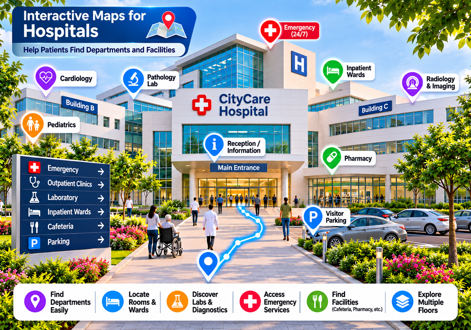
Interactive Maps for Hospitals: Help Patients Find Departments and Facilities
Discover how interactive hospital maps help patients, visitors, and healthcare staff locate departments, consultation rooms, laboratories, emergency services, parking areas, and essential hospital facilities.
Arriving at a hospital for a scheduled consultation, a diagnostic test, or to visit a loved one is rarely a routine experience. For many patients and caregivers, stepping onto a large medical campus brings heightened anxiety compounded by spatial confusion. Sprawling healthcare facilities featuring multiple interconnected buildings, specialized clinical units, multi-story wings, and winding corridors frequently make finding specific departments a frustrating ordeal.
Patients, family members, elderly visitors, and outpatient clients routinely arrive with only a doctor's name, room number, or department title. Without clear directional guidance, identifying which building houses the target clinic, finding the correct elevator bank, or locating pathology laboratories and diagnostic centers can turn a stressful medical visit into an exhausting search.
Implementing interactive maps for hospitals offers a practical, modern approach to patient and visitor wayfinding. By digitizing hospital floor plans and making interactive maps accessible on mobile devices and desktop web browsers, hospital administrators, facility managers, and patient experience teams can organize location data, streamline arrival flows, and provide accessible spatial guidance across complex healthcare properties.
What Is an Interactive Map for a Hospital?
An interactive hospital map is a digital, web-responsive visual representation of a healthcare facility or medical campus that displays hospital buildings, clinical departments, consultation rooms, diagnostic centers, emergency services, reception desks, and visitor amenities in an organized digital format.
Unlike static metal directory boards in lobbies or printed paper brochures handed out at information counters, digital hospital maps allow users to view the entire property overview, zoom into specific floor levels, search for medical departments by keyword, and tap points of interest (POIs) to review location details, such as room numbers, operating hours, or department guidelines.
A Real-World Example
Consider a patient arriving at a multi-building medical center for an outpatient cardiology appointment and a subsequent blood test. Instead of wandering through long, identical corridors or stopping busy nurses for directions, the patient opens the hospital's digital map on their smartphone or scans a QR code at the main entrance lobby. They search for "Cardiology Clinic," view the exact building and floor level (Building B, Level 3), see that the pathology lab is conveniently located just down the same corridor, and navigate directly to their appointments without stress.
Why Hospitals Need Better Patient Navigation
Managing spatial navigation across expanding medical properties presents distinct operational and emotional challenges for healthcare institutions:
-
Large & Complex Campus Architectures: Modern medical facilities often span multiple interconnected buildings, parking structures, and historical wings developed over decades.
-
Specialized Clinical Departments: Hospitals house dozens of distinct medical specialties, outpatient clinics, and administrative units that require precise labeling.
-
Multi-Floor Vertical Transit: Departments spread across upper levels require clear elevator, escalator, and stairwell guidance.
-
High-Stress Visitor Demographics: Patients, elderly individuals, and anxious family members have reduced cognitive bandwidth to interpret complex, static architectural signage.
-
Frequent Department Relocations: Clinical expansions and internal restructuring mean physical wall signs and printed directories become outdated rapidly.
-
Overburdened Reception Staff: Front-desk information personnel and clinical nurses spend excessive time answering routine directional questions rather than focusing on patient care and administration.
Clear, accessible, and accurate spatial information helps eliminate navigation uncertainty, ensuring a calmer and more efficient visit for everyone on-site.
Key Benefits of Interactive Maps for Hospitals
Adopting digital wayfinding solutions for healthcare facilities delivers practical advantages across patient care, visitor experience, and hospital operations:
1. Help Patients Find Hospital Departments
Organized department directories linked directly to mapped floor plans allow patients to locate specific medical units—such as Cardiology, Orthopedics, Pediatrics, Radiology, or Dermatology—instantly without guessing. Note: An interactive map assists with location discovery; it does not diagnose medical conditions or determine required treatments.
2. Make Consultation Rooms Easier to Locate
Mapping consultation rooms, outpatient suites, and doctors' offices helps patients understand precisely where their scheduled appointments take place, displaying clear room numbers and floor designations.
3. Help Visitors Find Laboratories and Diagnostic Centers
Digital maps help patients and caregivers locate pathology laboratories, imaging departments, blood collection centers, and diagnostic testing suites quickly.
4. Improve Access to Emergency Departments
Clearly identifying emergency department locations, ambulance bays, and emergency-specific entry routes ensures urgent visitors find critical care portals without delay. Important: Emergency location information must be verified and coordinated with official hospital safety protocols. A digital map complements, but never replaces, physical emergency signage, staff instructions, or professional emergency services.
5. Make Hospital Facilities Easier to Find
Organized facility categories make it easy for visitors to locate essential everyday amenities, including:
-
Elevators, staircases, and vertical transit hubs
-
Public restrooms and family care rooms
-
Waiting areas and patient lounges
-
Cafeterias, vending zones, and coffee kiosks
-
Retail pharmacies and gift shops
-
Information desks and security counters
-
Patient and visitor parking garages
6. Support First-Time Visitors and Caregivers
A clear visual overview gives family members and caregivers spatial awareness of unfamiliar medical campuses, reducing anxiety during extended hospital stays or emergency bedside visits.
7. Improve Hospital Information Sharing
Healthcare administrators can publish a centralized digital site map accessible via web links or QR codes, ensuring consistent spatial information across official hospital patient portals and websites.
8. Support a More Organized Hospital Experience
Structured digital location data reduces bottlenecks around main information desks by empowering tech-savvy visitors to self-navigate straightforward routes.
What Should a Hospital Map Include?
Hospital administrators should curate a comprehensive checklist of location markers and details when setting up an interactive digital healthcare map:
-
Hospital Name & Master Site Layout: Clear visual graphics displaying overall campus boundaries, building blocks, and outdoor walkways.
-
Hospital Buildings & Wings: Searchable identifiers for distinct clinical towers, diagnostic wings, and research blocks.
-
Medical Departments & Clinics: Outlined zones for outpatient clinics, specialty centers, and administrative units.
-
Consultation Rooms & Suites: Labeled numbers and names for doctors' offices and examination rooms.
-
Laboratories & Diagnostic Imaging: Pathology labs, MRI/X-ray imaging suites, and blood collection counters.
-
Emergency Department (ED): Clearly designated emergency entry points and triage desks.
-
Reception & Information Desks: Main lobby check-in counters and wayfinding help desks.
-
Pharmacy Outlets: On-site retail and discharge pharmacies.
-
Vertical Transit: Elevators, escalator banks, and emergency stairwells.
-
Public Amenities: Restrooms, waiting lounges, dining facilities, and infant feeding rooms.
-
Parking Structures & Transport: Visitor parking garages, patient drop-off zones, accessible parking bays, and shuttle stops.
-
Accessible Entrances & Routes: Verified step-free entryways, ramps, and elevators.
-
Emergency Assembly Points: Verified safety zones and evacuation assembly areas approved by facility management.
Privacy & Security Note: Hospital administrators must protect patient privacy and operational security. Never display restricted clinical wards, private patient room numbers, surgical suites, high-security pharmaceutical storage, or confidential staff areas on public-facing web maps.
Interactive Hospital Maps vs. Traditional Hospital Directories
While static metal directory boards in lobbies and printed paper guides provide basic physical landmarks, digital interactive maps offer significant functional advantages.
| Feature | Traditional Hospital Directory | Interactive Digital Map |
| Viewing Hospital Layout | Fixed, static overview panel in main lobbies | Interactive visual floor plan viewable on mobile devices |
| Finding Departments | Relies on small printed text and static directory lists | Searchable department markers with category filters |
| Locating Consultation Rooms | Requires reading complex text lists and wall signs | Clickable room numbers and floor designations |
| Finding Diagnostic Facilities | Limited to generic text on physical boards | Highlighted facility markers easily found on mobile |
| Accessing Facility Details | Restricted to concise text labels on signs | Rich pop-up profiles with operating hours and guidelines |
| Updating Information | Requires physical reprinting and sign replacement | Digital map content can be updated online instantly |
| Sharing Location Data | Impossible to share digitally prior to arrival | Shareable via website URLs, web links, and QR codes |
How to Create an Interactive Hospital Map
Building an interactive map for a medical center or hospital campus follows a structured implementation workflow:
Step 1: Collect an Accurate Hospital Floor Plan
Gather up-to-date architectural floor plans and site layouts for all buildings that need to appear on the digital map. Verify building names, department locations, floor designations, and shared facilities.
Step 2: Identify Important Departments and Facilities
Compile an organized master list of medical departments, outpatient clinics, consultation rooms, diagnostic labs, emergency services, and visitor amenities. Ensure room numbers match physical door signage.
Step 3: Organize Locations Into Categories
Group site locations into intuitive categories (e.g., Clinical Departments, Diagnostic Services, Emergency, Visitor Facilities, Parking & Access, Building Amenities).
Step 4: Select Suitable Mapping Software
Choose a web-first mapping platform that supports your floor plan image formats, multi-floor layer switching, custom marker placements, and publishing requirements.
Step 5: Add Location Markers and Details
Plot pins, upload room labels, add department descriptions, and assign floor information according to the selected platform's capabilities. Keep typography clear and legible.
Step 6: Verify Accessibility and Public Information
Review accessible entrances, elevators, public pathways, and visitor facilities. Ensure that accessibility information is verified on-site rather than assumed. Check that confidential or restricted hospital areas remain hidden.
Step 7: Test the Interactive Map
Thoroughly test the completed interactive map before publishing. Perform usability checks across multiple environments:
-
Location Accuracy: Verify that map pins match physical room and floor positions accurately.
-
Label Clarity: Confirm room text and department names are easily legible.
-
Cross-Device Performance: Test search responsiveness, touch controls, and map zooming across smartphones, tablets, and desktop displays.
-
User Feedback: Ask individuals unfamiliar with the hospital layout to locate sample destinations using the map.
Step 8: Publish and Share the Map
Deploy your interactive healthcare floor plan across digital touchpoints:
-
Website Embedding: Insert the map's embed code directly onto your hospital's contact or visitor web pages.
-
Direct Web URL Sharing: Share direct map links in pre-appointment confirmation emails or patient portal notifications.
-
QR Code Displays: Generate QR codes pointing to the map URL and display them on lobby entrance posters or information desks (subject to hospital management approval).
Step 9: Review and Update Hospital Information
Establish an operational schedule to review your digital map periodically. Update mapped details immediately whenever clinical departments relocate, consultation rooms change, or new facilities open.
How Hospital Administrators Can Use Digital Maps
Digital mapping solutions serve as valuable operational tools for healthcare administration teams:
-
Streamlining Patient Arrival: Helping outpatients find consultation rooms independently, reducing late arrivals for scheduled appointments.
-
Supporting Caregivers & Families: Giving visitors clear spatial guidance to intensive care waiting areas, patient wards, and visitor lounges.
-
Organizing Multi-Building Campuses: Providing a centralized digital directory for expansive medical complexes comprising multiple clinical towers.
-
Reducing Lobby Congestion: Empowering tech-savvy visitors to self-navigate straightforward routes, easing lines at information reception desks.
-
Enhancing Digital Patient Portals: Integrating interactive map links into pre-appointment reminder emails and mobile health applications.
Note: Interactive digital maps complement—rather than replace—hospital reception staff, directional wall signage, verbal staff instructions, and formal emergency protocols.
Best Practices for Designing an Effective Hospital Map
To ensure a digital hospital map delivers maximum utility and trust, healthcare administrators should follow these core design recommendations:
-
Use Clear, Standardized Department Names: Ensure digital labels match official medical department titles and physical door signs precisely.
-
Display Accurate Building and Floor Data: Clearly distinguish upper-level floors, basement levels, and separate campus blocks.
-
Organize Clinical Units Intuitively: Group locations logically so users can filter by Outpatient Clinics, Diagnostics, or Visitor Services effortlessly.
-
Design for High Accessibility: Choose high-contrast color schemes, legible typography, and accessible visual markers suitable for older adults and individuals with visual impairments.
-
Clearly Identify Emergency & Welfare Points: Ensure emergency departments, pharmacies, restrooms, and security posts are easy to find.
-
Protect Patient Confidentiality: Strictly exclude private clinical wards, restricted treatment spaces, and confidential staff data from public-facing maps.
-
Verify Information Before Publishing: Conduct physical walk-throughs to confirm map markers align accurately with physical corridors and rooms.
-
Establish an Update Workflow: Assign operational responsibility to a specific team member to publish map updates whenever clinic locations change.
Common Hospital Mapping Mistakes to Avoid
When setting up a digital healthcare map, avoid these common implementation pitfalls:
-
Using Outdated Floor Plans: Relying on old architectural layouts that fail to show recent clinic relocations or wall renovations misleads patients.
-
Inconsistent Department Naming: Labeling a clinic "Heart Center" on the digital map while physical signs read "Cardiology Suite" creates confusion.
-
Incorrect Floor Designation: Assigning a department to the wrong floor level causes immense frustration for vulnerable patients.
-
Omitting Essential Amenities: Forgetting to mark public restrooms, elevators, or waiting areas impairs visitor comfort.
-
Neglecting Mobile Usability: Failing to test map load times and touch controls on mobile browsers leads to poor user experiences for patients on smartphones.
-
Exposing Restricted Data: Accidentally publishing confidential clinical areas or private staff zones compromises hospital security and privacy regulations.
-
Failing to Maintain Content: Leaving map errors uncorrected after departmental restructuring damages trust in digital hospital resources.
How to Choose Hospital Mapping Software
Healthcare administrators and IT managers evaluating digital mapping platforms should compare software solutions against key operational criteria:
-
Supported Map & Floor Plan Formats: Confirm whether the platform accepts vector graphics or image renders representing multi-story building levels.
-
Mobile Browser Responsiveness: The platform must display cleanly and load fast inside standard web browsers across iOS and Android without forcing visitors to download a native app.
-
Search & Category Capabilities: Robust search tools capable of matching medical department titles, doctor names, and facility categories (e.g., "Radiology" or "Restroom").
-
Customization & Healthcare Branding: Options to apply custom brand colors, clean institutional fonts, and official hospital logos.
-
Embedding & Sharing Flexibility: Simple options to embed interactive maps into hospital websites, patient portals, and generate shareable web links or QR codes.
-
Privacy, Security & Compliance: Reliable cloud infrastructure adhering to strict data privacy standards, backed by clear documentation and responsive customer support.
How eMap.live Fits Into an Interactive Hospital Mapping Workflow
For hospital administrators, facility managers, and healthcare IT teams seeking an efficient way to build and share digital floor plans, eMap.live provides a flexible, web-based interactive mapping platform.
By visiting https://emap.live/, healthcare administrators can review how the platform supports commercial and institutional property mapping use cases. Verified platform capabilities relevant to hospitals include:
-
Custom Vector Map Building: Transform architectural floor plan renders into clean, mobile-friendly interactive maps featuring clickable department markers and facility pins.
-
App-Free Mobile Access: Maps run directly inside standard mobile web browsers on iOS and Android devices, allowing patients and visitors to view hospital layouts instantly without app store downloads.
-
Searchable Directories & Categories: Organize medical departments, diagnostic suites, and visitor amenities into custom searchable categories (e.g., Clinical Outpatient, Diagnostics, Emergency, Visitor Services), making destinations easy to find.
-
QR Code & Web Link Sharing: Easily generate shareable web links and QR codes to display on lobby posters, entrance signage, or appointment confirmation portals.
-
Simple Dashboard Management: Update department labels, edit room descriptions, or adjust facility pins quickly through an intuitive web management dashboard without coding skills.
Hospital administrators should visit eMap.live to inspect current platform features, supported graphic formats, and documentation to determine how it fits their healthcare facility mapping workflow.
Frequently Asked Questions
1. What is an interactive map for a hospital?
An interactive map for a hospital is a digital, mobile-responsive visual guide that displays clinical departments, consultation rooms, laboratories, diagnostic centers, emergency services, and visitor amenities. Accessible via web browsers, it helps patients and visitors navigate healthcare facilities easily.
2. How do interactive maps help patients navigate hospitals?
Digital maps provide searchable location databases and clear visual markers directly on mobile devices. Patients can locate specific consultation rooms, find outpatient clinics, and identify diagnostic labs without getting lost in complex corridors.
3. What should a hospital map include?
A hospital map should include hospital buildings, clinical departments, outpatient clinics, consultation rooms, pathology laboratories, diagnostic imaging centers, emergency departments, reception desks, elevators, restrooms, waiting areas, and visitor parking.
4. Can interactive maps show multiple hospital departments?
Yes. Digital mapping platforms allow administrators to plot and label multiple clinical departments, specialty clinics, and administrative units across multi-story building layouts, making specific units easy to search and identify on-screen.
5. How can visitors find doctors' offices and consultation rooms?
Visitors can open the hospital's digital map on their smartphone, search for a doctor's name or clinic room number, or filter by medical department categories to view exact visual floor locations and nearby elevator banks.
6. Can hospital maps show laboratories and diagnostic centers?
Yes. Digital maps can highlight pathology laboratories, blood collection counters, and radiology/imaging suites to guide outpatients directly to their scheduled diagnostic appointments.
7. How can hospitals create interactive digital maps?
Hospitals can create a map by collecting architectural floor plans, compiling department lists, categorizing locations, uploading graphics to an interactive map platform like eMap.live, adding markers and descriptions, testing mobile performance, and sharing via QR codes or web links.
8. Can QR codes be used to share hospital maps?
Yes. Hospital administrators can generate QR codes linked directly to their interactive map URL. Placing these QR codes on lobby signboards, appointment confirmation letters, or digital kiosks allows patients to launch the map instantly on their phones.
9. What are the benefits of digital wayfinding in healthcare facilities?
Digital wayfinding improves department discovery for outpatients, reduces visitor stress, eases congestion at reception information desks, and organizes complex healthcare facility layouts efficiently.
10. What should hospitals consider when choosing mapping software?
Hospitals should evaluate software based on mobile web performance, multi-floor support, ease of content updates, custom healthcare branding, category search capabilities, data privacy compliance, and cloud reliability.
11. Can interactive hospital maps replace hospital staff or emergency signage?
No. Digital maps complement—rather than replace—hospital reception staff, verbal directions, physical wall signage, and mandatory emergency exit procedures.
Conclusion: Make Hospital Navigation Easier for Everyone
Providing clear, accessible spatial guidance is a vital component of modern healthcare administration. As medical centers expand and patient expectations favor digital self-service solutions, traditional paper brochures and static lobby billboards alone are no longer sufficient to guide visitors effectively.
Interactive maps for hospitals bridge the gap between complex physical architecture and digital convenience. By organizing department layouts, publishing searchable clinical directories, highlighting visitor amenities, and providing mobile web access via QR codes, hospital administrators can eliminate spatial confusion, reduce patient stress, and elevate the overall healthcare experience.
