16 Must-Have Features Every Interactive Mapping App Should Include in 2026
Everything you need to evaluate, compare, and choose the right interactive mapping app for events, campuses, sports complexes, parks, and visitor destinations in 2026.
Introduction
Interactive mapping apps have rapidly evolved from basic navigational tools into robust, feature-rich digital ecosystems. They play a pivotal role in streamlining operations, boosting visitor engagement, and uncovering actionable behavioral insights. Whether you are overseeing a multi-acre university campus, coordinating a high-density corporate event, managing a state-of-the-art sports complex, or mapping scenic public park trails, choosing the right digital wayfinding solution is an operational necessity.
With an array of tech providers flooding the market, evaluating the noise can be incredibly challenging. Some platforms offer simple geometric maps, while others deliver advanced interior routing, frictionless QR integrations, real-time data sync, and sponsor monetization metrics. Finding an agile architecture that fulfills your immediate spatial needs while matching your long-term growth roadmap is the key to a successful deployment.
This comprehensive checklist provides an objective evaluation framework to help you spot the features that truly matter in 2026.
Why Interactive Mapping Apps Matter
Modern mobile-first visitors view interactive digital guidance as a baseline expectation rather than a luxury. When individuals arrive at a sprawling venue, they want to safely, independently, and instantly locate points of interest directly from their smartphones.
Legacy, unclickable static mediums trigger clear operational bottlenecks:
-
Outdated Information: Physical signs or downloadable files cannot handle last-minute room changes or schedule shifts.
-
Frustrating Ergonomics: Legacy PDFs force users into clumsy pinch-to-zoom scrolling while walking.
-
Zero Search Indexing: Forcing visitors to scan dense blueprints manually spikes anxiety and confusion.
-
Blind Operations: Management cannot measure traffic bottlenecks, frequent user search terms, or dead zones.
Interactive mapping platforms systematically wipe out these friction points, driving down organizational print overhead while significantly elevating the visitor experience.
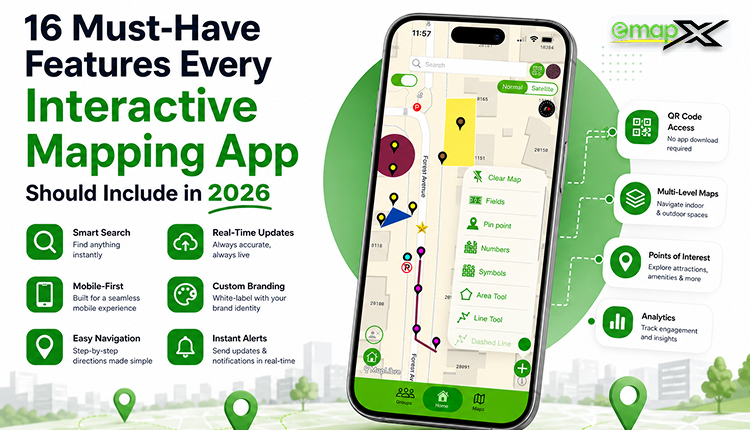
Interactive Mapping App Evaluation Checklist
Use this 16-point evaluation framework when vetting potential platform vendors:
1. Interactive Digital Real Estate
The absolute foundation of your mapping software must be a fluid, dynamic digital canvas.
-
Key Requirements:
-
Smooth multi-touch pan and pinch-to-zoom responsiveness.
-
Clickable spatial elements that trigger detailed informational panels.
-
Layered view support to easily toggle complex data (e.g., separating food trucks from emergency exits).
-
2. Frictionless QR Code Map Access
Forcing an attendee to download a heavy mobile application introduces severe digital friction. QR code navigation has become the definitive onboarding tool.
-
Key Requirements:
-
Instant web-app rendering directly inside native mobile browsers (iOS/Android) upon scanning.
-
Completely app-free configuration—no App Store or Google Play account required.
-
Simplified single-click URL links for seamless integration on social channels or email blasts.
-
3. Real-Time Cloud Updates
Physical environments are inherently fluid. Venues must possess the flexibility to update operational elements on the fly.
-
Key Requirements:
-
A centralized, cloud-hosted administrative dashboard.
-
Instant, client-side graphic and textual updates without requiring page-refreshes.
-
Dynamic notifications to easily communicate sudden room changes or parking section closures.
-
4. Robust Search & Directory Indexing
Visitors should never spend precious time guessing where an asset resides inside a massive floor plan.
-
Key Requirements:
-
Lightning-fast keyword and category-filtered search fields (e.g., searching specifically for "Restrooms").
-
Smart autocomplete functions and alternative alias tagging (e.g., tying "WC" or "Bathroom" to the same destination pin).
-
5. Mobile-First Ergonomic Design
The overwhelming majority of your users will view your maps single-handed while actively walking through your property.
-
Key Requirements:
-
Lightweight code architectures optimized for fast loading on congested data networks.
-
Touch-friendly, intuitive navigation buttons situated within easy thumb reach.
-
6. True Digital Wayfinding
A premier app goes far beyond pinning an icon on a layout; it dynamically demonstrates the optimal physical path to traverse.
-
Key Requirements:
-
Legible, highly visible multi-point routing paths.
-
Turn-by-turn walking trajectories that adapt dynamically across multi-floor venues.
-
7. Core Compliance & Accessibility (ADA / WCAG)
In 2026, web-based public entity services must strictly match rigorous accessibility guidelines (such as WCAG 2.1 Level AA benchmarks). Inclusion cannot be an afterthought.
-
Key Requirements:
-
Dedicated accessibility toggles that completely bypass stairs or steep terrains.
-
Explicitly highlighted step-free paths, elevator banks, wheelchair ramps, and ADA parking zones.
-
8. Contextual Location Hubs
Every pin on your interactive canvas should transform into a deep informational asset when tapped.
-
Key Requirements:
-
Support for rich media, high-resolution imagery, and text descriptions.
-
Embedded touch-to-call details, operating hours, and live links to sponsor promos.
-
9. Unified Website Integration
Ensure your map is highly discoverable long before visitors ever arrive on-site.
-
Key Requirements:
-
Low-code iframe embedding to place maps cleanly inside external web portals or event registration sites.
-
Uniform cross-browser stability spanning desktop and mobile viewports.
-
10. White-Label Branding Controls
To retain a premium, cohesive digital presentation, your mapping layer must seamlessly match your identity.
-
Key Requirements:
-
Complete customization capabilities for custom hex brand colors, logos, and typography styles.
-
Custom vector icons tailored to your exact industry theme.
-
11. Privacy-First Behavior Analytics
Transitioning to digital mapping provides a powerful window into consumer desires and physical bottlenecks.
-
Key Requirements:
-
Aggregated, anonymized dashboards showing peak traffic hours and high-volume location clicks.
-
Comprehensive search term reports to identify what visitors are looking for but can't find.
-
12. Centralized Multi-Venue Configuration
Enterprise companies managing separate geographical networks require a framework that easily scales.
-
Key Requirements:
-
The capacity to manage multiple distinct properties or changing event layouts from one singular administrative profile.
-
13. Live Programming & Calendar Integration
For time-sensitive environments like music festivals or major trade expos, schedules must directly tie to coordinates.
-
Key Requirements:
-
Interactive session links that display exactly who or what is presenting at a designated pin at any given hour.
-
14. Integrated Sponsorship Real Estate
Transform an operational tool into a robust, high-impact revenue generator.
-
Key Requirements:
-
Premium sponsored map pins featuring partner corporate logos.
-
Targeted promotional pop-up opportunities or banner real estate built into the UI.
-
15. Total Paper & PDF Replacement
A successful digital migration means completely moving past static, non-interactive files.
-
Key Requirements:
-
Capabilities comprehensive enough to fully eliminate the heavy recurring costs of printing seasonal paper directories.
-
16. Future-Ready Technical Adaptability
Protect your capital investment for the next decade by selecting a scalable, forward-looking software foundation.
-
Key Requirements:
-
Compatibility with upcoming technical innovations like Augmented Reality (AR) pathing layers and precision indoor positioning (IPS) hardware.
-
Mapping Requirements at a Glance
| Feature Category | High-Tier Interactive Apps | Legacy Static PDFs | Printed Paper Brochures |
| Real-Time Data Sync | Instant, automatic cloud push | Manual file overwrite needed | Permanently unchangeable |
| User Interaction | Keyword search & level filters | Pinch-to-zoom scrolling only | Manual eye-scanning only |
| Access Friction | Zero (Instant QR browser render) | High (Heavy file download) | High (Requires physical pickup) |
| Accessibility Equity | Advanced step-free route toggles | Static iconography symbols | Tiny, unalterable map legends |
| Monetization Engine | Premium interactive pins & pop-ups | Fixed logo placement grids | Static, unchanging print ads |
| Metrics Visibility | Tracks search words & foot traffic | Completely invisible data | Completely unmeasurable |
Industries Capitalizing on the Shift
-
Universities & Colleges: Empowering incoming students, parents, and visiting guests to freely navigate complex academic blocks, libraries, and campus facilities.
-
Events & Conferences: Driving seamless crowd transitions between dense trade show exhibitor booths, main keynote halls, and designated networking zones.
-
Sports Stadiums & Arenas: Routing thousands of excited ticket holders directly to their target seating sections, pre-booked parking decks, merchandise stands, and concessions.
-
Parks & Recreation Systems: Equipping trailheads with responsive mobile layouts tracking winding hiking trails, scenic lookouts, and safety checkpoints.
-
Corporate Office Parks: Assisting remote employees, out-of-town executives, and prospective clients in independently locating meeting rooms and offices across multi-building grounds.
Achieving the Baseline with emapX Live
When executing a flawless spatial migration, organizations look to specialized, production-ready systems like emapX - Live Custom Maps to anchor their digital layout. emapX Live provides a robust, low-code mapping ecosystem engineered to check every essential requirement on this comprehensive evaluation framework.
By beautifully marrying stunning fluid graphics, lightning-fast cloud updates, and frictionless app-free QR code deployment with sophisticated accessibility filters and sponsor monetization channels, emapX Live enables facilities to confidently digitize their physical footprint. It bridges the gap between physical real estate and modern mobile convenience, delivering an elite spatial layer that today’s digital-native public relies on.
Frequently Asked Questions
What exactly is an interactive mapping app?
An interactive mapping app is a cloud-hosted digital navigation platform that allows users to seamlessly search, pan, zoom, and navigate physical layouts via responsive digital graphics and live info profiles.
Why is avoiding a mandatory app download considered an absolute necessity?
Forcing visitors to download a dedicated app from an app store creates an immediate barrier to entry. Due to low on-site cellular data signals, device storage limitations, or basic time constraints, most users will decline the download. Web-app maps launched via a QR code load instantly in any native browser.
Can an interactive map fully replace traditional printed sheets?
Yes. Interactive maps execute all the traditional display duties of a paper print, while adding layers of modern value—such as keyword search indexes, live data synchronization, and accessibility filters—all while completely erasing recurring print production costs.
Is visitor location tracking a private data concern?
No. Enterprise mapping solutions prioritize privacy compliance by exclusively harvesting anonymous, aggregated behavior metrics. The software does not track specific personal identities or private user records; it simply logs general data trends like high-volume keyword queries or popular pin clicks to help administrators strategically optimize their physical venue configurations.
Conclusion
Selecting the right interactive mapping platform goes far deeper than simply matching screenshots or reviewing pricing scales. It requires an intentional dedication to accessibility compliance, real-time administrative flexibility, and responsive mobile data delivery. By measuring your software options against this rigid 16-point feature framework, your management team can confidently select a scalable wayfinding platform that simplifies crowd navigation, maximizes partner revenue, and protects your technological scalability for years to come.
As public standards lean heavily into instant digital convenience through 2026, launching a robust tool like emapX Live guarantees your venue remains on the cutting edge. Upgrading your physical environment into a connected digital landscape is the single most effective method to ensure your visitors move safely, efficiently, and confidently.