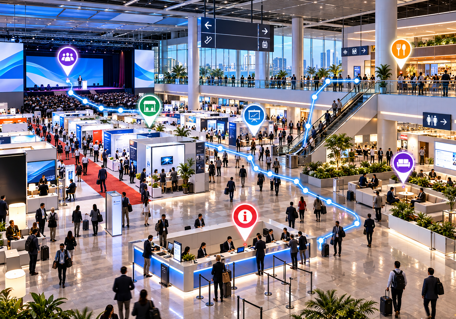
Digital Wayfinding for International Conferences & Trade Shows
Discover how digital wayfinding and interactive maps help attendees navigate conference venues, find exhibition booths, locate meeting rooms, and enjoy a smoother event experience.
Introductory Excerpt:
Navigating massive international convention centres and multi-hall trade shows can be an overwhelming experience for attendees, exhibitors, and organisers alike. Discover how digital wayfinding and interactive venue maps eliminate navigation friction, increase booth discovery, and elevate the overall event experience.
Navigating a major international conference, trade show, or exhibition can easily become an overwhelming task. Multi-hall convention centres, thousands of exhibitor booths, dozens of concurrent breakout sessions, crowded networking lounges, and unfamiliar architectural layouts often turn simple venue traversal into a frustrating search. Attendees routinely struggle to locate specific presentation stages, find scheduled exhibitor stands, or identify basic amenities like registration desks, food courts, and restrooms.
Unclear venue navigation does not just inconvenience visitors—it impacts event operations, causes delayed session starts, reduces booth foot traffic for exhibitors, and increases the burden on information desk staff.
Digital wayfinding for conferences offers a modern, accessible approach to event navigation. By replacing static floor plans with interactive, web-accessible digital maps, event organisers can provide seamless venue guidance directly to attendees' mobile devices, ensuring a smoother and more engaging event experience.
What Is Digital Wayfinding for Conferences and Trade Shows?
Digital wayfinding for conferences and trade shows refers to the use of interactive digital maps, mobile-responsive web interfaces, and visual venue directories to guide attendees, exhibitors, and speakers through an event venue.
Unlike traditional static maps, digital wayfinding allows users to search for specific locations, filter by categories (such as exhibitor industries, session topics, or venue amenities), zoom into multi-level hall plans, and view location details on their smartphones, tablets, or desktop screens.
To understand its role in modern event technology, it helps to differentiate digital wayfinding from traditional event navigation tools:
-
Printed Floor Plans: Typically distributed in physical event guides, paper maps are easily misplaced, difficult to read on small scales, quickly become outdated when booth assignments change, and contribute to event paper waste.
-
Static PDF Maps: While viewable on mobile devices, static PDF files require awkward pinching and zooming, lack search functionality, and offer no interactive category filtering.
-
Physical Venue Signage: Wall maps, hanging banners, and directional signs provide critical physical landmarks, but they are limited in the amount of detail they can display and cannot easily adapt to mid-event schedules or room changes.
-
Digital Event Maps: Web-based, interactive maps allow attendees to search for specific exhibitor names, locate session rooms, tap on points of interest for descriptions, and view clear visual locations on demand.
For example, at a multi-building medical congress, an attendee can open an interactive web map, search for a specific medical device manufacturer or keynote auditorium, and instantly view its precise floor and room location without wandering through crowded corridors.
Why Large Events Need Better Navigation
Navigating large-scale international trade shows and multi-day conventions presents distinct spatial and operational challenges:
1. Sprawling Exhibition Halls and Complex Venues
International convention centres often span hundreds of thousands of square metres across multiple connected halls, vertical floors, and outdoor plazas. Attendees entering through a main plaza can easily lose their sense of direction once inside.
2. High Density of Exhibitor Booths
Trade shows featuring hundreds or thousands of exhibitor stands can look remarkably uniform. Finding a specific vendor among rows of similar booth structures without digital search tools can be time-consuming.
3. Distributed Conference Sessions and Keynote Stages
Conferences often run concurrent tracks across widely separated rooms. When attendees have only 10 to 15 minutes between sessions, struggling to locate a room can mean missing key presentations.
4. High-Traffic Essential Amenities
Locating registration desks, badge printing kiosks, coat checks, restrooms, accessible elevators, charging stations, and food courts quickly is essential for attendee comfort and smooth crowd flow.
5. International and First-Time Attendees
International events bring together visitors who are unfamiliar with the venue layout and may face language barriers. Visual, intuitive digital maps help bridge communication gaps.
When navigation is unclear, attendees spend valuable time searching for locations rather than networking, attending sessions, or visiting exhibitors.
Key Benefits of Interactive Conference Maps
Implementing digital wayfinding software delivers clear advantages for event organisers, venue managers, exhibitors, and attendees:
-
Easier Attendee Navigation: Empowers visitors to find session rooms, exhibitor stands, and amenities independently using their own smartphones.
-
Better Exhibitor Discovery: Enables attendees to search for exhibitors by name or product category, driving higher foot traffic to booth locations across all halls.
-
Less Venue Confusion: Reduces bottlenecking near entrances and information desks by providing clear visual destinations.
-
Improved Information Access: Centralises venue details, booth numbers, stage schedules, and facility locations in one easily accessible link.
-
Mobile Accessibility: Eliminates the need for native app downloads when using browser-based, mobile-friendly map platforms.
-
Reduced Printing Requirements: Decreases reliance on large runs of paper maps, supporting event sustainability initiatives and reducing printing costs.
-
Simplified Layout Updates: Allows organisers to correct booth labels, reassign meeting rooms, or update facility locations digitally in real time.
Essential Locations to Include on a Digital Trade Show Map
A comprehensive trade show map should provide clear visual representation and searchable labels for all primary event zones:
| Category | Key Locations | Map Purpose |
| Exhibition Zones | Booths, pavilions, sponsor stands | Vendor discovery & product searches |
| Conference Spaces | Keynote stages, breakout rooms | Session navigation & speaker schedules |
| Registration & Services | Badge printing, info desks | Arrival orientation & attendee check-in |
| Amenities & Rest | Restrooms, cafes, lounges, charging | Comfort & dining access |
| Transit & Exits | Entrances, parking, rideshare, shuttles | Ground transport & venue departures |
Exhibition Booths and Pavilions
Plot individual booth numbers, country pavilions, sponsor stands, and featured demonstration zones clearly with distinct visual outlines and labels.
Conference Halls and Session Rooms
Mark main auditoriums, keynote stages, breakout rooms, workshop spaces, and speaker prep lounges.
Registration and Information Desks
Highlight badge pick-up counters, help desks, bag checks, and customer service stations located near venue entrances.
Restrooms and Accessible Facilities
Clearly indicate male, female, gender-neutral, and accessible restrooms, as well as elevators, ramps, and baby care rooms.
Food Courts, Cafes, and Networking Lounges
Show dining areas, coffee bars, sponsor lounges, dedicated meeting pods, and press rooms to help attendees plan breaks and networking meetings.
Entrances, Exits, and Transit Links
Mark main hall entrances, taxi stands, rideshare pickup zones, shuttle stops, parking garages, and venue connection walkways.
Emergency Facilities
Include venue-approved locations for first aid stations, security desks, and emergency exits to support event safety protocols.
Digital Wayfinding vs. Traditional Event Maps
While physical signage and printed floor plans still play a supporting role at large events, digital interactive maps offer distinct operational and user-experience advantages.
| Feature | Traditional Printed Event Maps | Interactive Digital Event Maps |
| Ease of Access | Physical distribution at entrance desks | Instant access via web links, URLs, or QR codes |
| Searchability | Manual visual scanning across print grids | Instant keyword search for booth numbers or vendors |
| Updating Information | Impossible after printing; requires reprints | Updated instantly via a digital admin dashboard |
| Mobile Usability | Physical paper sheet or static image | Responsive layout optimised for smartphone screens |
| Information Depth | Limited to short text labels and booth numbers | Rich details, including descriptions, links, and photos |
| Sustainability | Generates paper waste and unused inventory | Eco-friendly, paperless digital distribution |
| Backup Role | Functions independently of device batteries | Requires internet access and smartphone battery power |
Note: Printed overview maps and wall signage remain valuable secondary tools for quick spatial orientation or for visitors who prefer non-digital options.
How to Create an Interactive Conference Map
Creating a digital event map follows a straightforward, step-by-step process:
-
Obtain an Accurate Venue Floor Plan: Secure vector floor plans, CAD files, or high-resolution architectural layouts from the convention centre or venue management.
-
Identify Key Locations and Zones: Audit all exhibition halls, booth layouts, session rooms, entrances, food courts, and amenities.
-
Organise Destinations into Categories: Group locations logically (e.g., Exhibitors, Stages, Dining, Amenities, Entrances) to enable easy filtering.
-
Select a Mapping Platform: Choose an interactive map software that matches your event scale, mobile accessibility goals, and budget.
-
Plot Markers and Add Descriptions: Upload the venue graphic, add points of interest, assign booth numbers, and include descriptive text or vendor profiles.
-
Apply Event Branding: Customise map colours, pins, typography, and logos to align with the conference's visual identity.
-
Test Across Devices: Verify that the map performs smoothly on various smartphone screens, tablets, and desktop web browsers.
-
Publish and Distribute: Share the map URL via the event website, attendee confirmation emails, mobile portals, and venue signage.
-
Review and Update: Audit booth labels and room assignments prior to doors opening, updating details as late changes occur.
How QR Code Maps Can Improve Event Navigation
Integrating QR codes across physical event touchpoints is one of the most efficient ways to connect attendees to an interactive venue map without requiring mobile app downloads.
| Touchpoint | Physical Location | Primary Purpose |
| Entrance Signage | Plaza banners & lobby posters | Immediate venue orientation upon arrival |
| Registration Desks | Badge counters & info tables | Self-service mapping while picking up credentials |
| Keynote Lobbies | Auditorium doors & stage entryways | Finding specific breakout session rooms nearby |
| Printed Guides | Event programs & pocket schedules | Digital expansion of physical print materials |
| Attendee Badges | Lanyard cards & digital passes | Personal, on-demand venue access throughout the stay |
When an attendee scans a QR code using their smartphone camera, the browser opens the interactive map instantly, allowing them to locate their destination in seconds.
How Event Organizers Can Choose the Right Mapping Software
When selecting a trade show mapping software or event wayfinding solution, event decision-makers should evaluate platforms against these operational requirements:
-
Ease of Map Creation and Updates: The platform should offer an intuitive dashboard that allows non-technical staff to add markers, edit labels, and publish updates quickly.
-
Mobile-First Browser Performance: The map must load fast and operate smoothly in standard mobile web browsers without forcing users to install a native app.
-
Search and Category Filtering: Robust search capability is essential for large trade shows, allowing users to search by vendor name, booth number, or amenity type.
-
Embedding and Sharing Options: Look for software that provides simple web embed codes, direct URL sharing, and QR-code generation tools.
-
Custom Branding Options: Ensure the software allows you to apply custom brand colors, logos, and tailored pin icons to match the event's identity.
-
Scalability and Support: Confirm the platform can handle peak web traffic during event opening hours and offers dependable customer support.
-
Privacy and Data Requirements: Verify that the software respects user privacy and operates efficiently without requiring unnecessary personal data collection.
How eMap.live Can Help With Interactive Event Maps
For event organizers seeking a straightforward, reliable way to build and share digital venue layouts, eMap.live offers a flexible interactive mapping solution.
eMap.live allows conference planners, exhibition managers, and venue teams to transform floor plans into searchable, mobile-responsive digital maps. Key verified features include:
-
Custom Interactive Map Creation: Upload venue graphics and create interactive points of interest for exhibition booths, session stages, and amenities.
-
Mobile Web Accessibility: Maps run directly in standard web browsers on iOS and Android devices, eliminating app store barriers for international visitors.
-
Searchable Locations & Categories: Organize destinations into custom categories, helping attendees search for specific vendors or room labels easily.
-
QR Code & Link Distribution: Easily generate web links and QR codes to display on physical venue banners, badge lanyards, or digital event portals.
-
Easy Content Management: Update booth details or room labels instantly through a simple management interface without needing technical coding skills.
If you are planning an upcoming conference or trade show, explore eMap.live to assess how its interactive mapping features can support your event navigation strategy.
Best Practices for Successful Conference Wayfinding
To ensure your digital venue map delivers maximum value to attendees, follow these industry best practices:
-
Use Clear, Standardized Labels: Label rooms and booths using the exact nomenclature shown on physical hall doors and official event schedules.
-
Organize Categories Intuitively: Keep category lists concise (e.g., Exhibitors, Main Stages, Food & Beverage, Restrooms, Services).
-
Maintain Visual Simplicity: Avoid cluttering the map with unnecessary graphic elements that make mobile viewing difficult.
-
Highlight High-Traffic Landmarks: Clearly identify major entrances, central walkways, escalators, and information desks as anchor points.
-
Combine Digital and Physical Tools: Use digital maps alongside directional floor stickers, overhead hall banners, and trained venue staff.
-
Test the Map In-Situ: Walk the venue floor prior to event opening while testing the map on a smartphone to verify point placement accuracy.
-
Assign Dedicated Update Roles: Appoint a team member responsible for publishing last-minute booth reassignments or schedule updates on the digital map.
The Future of Digital Wayfinding for International Events
As event technology continues to advance, digital venue navigation is evolving toward more connected passenger and attendee experiences:
-
App-Free Web Interfaces: A growing shift toward lightweight, browser-based web applications that eliminate friction for temporary event visitors.
-
QR-Driven Contextual Navigation: Scanning location-specific QR codes across large halls that automatically open the map centered on the attendee's current physical location.
-
Connected Digital Signage: Interactive touchscreen kiosks in lobby areas that allow visitors to scan a code and transfer visual map directions directly to their mobile screens.
-
Multilingual Information Delivery: Automated translation options within web map interfaces, enabling international attendees to view venue details in their native language.
By adopting accessible digital mapping solutions today, event organizers lay the foundation for modern, stress-free venue experiences.
Conclusion
Providing clear, accessible venue navigation is an essential component of modern conference and exhibition management. As trade shows grow in scale and complexity, static paper floor plans and physical signs alone are no longer sufficient to guide thousands of international attendees effectively.
Interactive digital maps eliminate spatial friction, increase foot traffic for exhibitors, streamline crowd flow, and elevate the overall event experience. By choosing a mobile-friendly mapping solution, organizing clear location categories, and deploying QR access points throughout the venue, event organizers can ensure their visitors spend less time lost in corridors and more time engaging with the event.
Ready to simplify venue navigation for your next conference or trade show? Discover how eMap.live can help you build clean, interactive digital maps tailored to your event requirements.
Frequently Asked Questions
1. What is digital wayfinding for conferences?
Digital wayfinding for conferences refers to interactive digital maps and web tools used to help attendees, exhibitors, and speakers navigate event venues. Accessible via smartphones, tablets, or web browsers, it provides searchable booth locations, session room guides, and visual facility directions.
2. How do interactive maps help trade show attendees?
Interactive maps allow trade show attendees to search for specific exhibitors, locate conference stages, find amenities like restrooms and cafes, and view clear visual layouts on their mobile devices, making large exhibition halls easier to navigate.
3. What should an interactive conference map include?
An interactive conference map should include exhibition booths, keynote auditoriums, breakout session rooms, registration desks, food courts, restrooms, accessible entrances, elevators, networking lounges, emergency exits, and transit links.
4. Can QR codes be used for conference venue maps?
Yes. Event organizers can place QR codes on entrance banners, registration desks, event programs, and badge lanyards. Attendees scan the QR code with their mobile phone camera to open the browser-based interactive map instantly without installing an app.
5. How can event organizers create a digital exhibition hall map?
Organizers can create a digital map by procuring a venue floor plan, categorizing key locations, selecting an interactive map platform like eMap.live, adding destination markers and descriptions, customizing brand styling, and sharing the map via QR codes and web links.
6. What is the difference between digital wayfinding and indoor navigation?
Digital wayfinding provides visual interactive maps, searchable location directories, and category guidance accessible on web browsers. Indoor navigation typically refers to advanced systems that offer real-time "blue-dot" position tracking using specialized indoor hardware like Bluetooth beacons.
7. How should organizers choose trade show mapping software?
Organizers should evaluate software based on ease of map creation, mobile web responsiveness, search capabilities, customization options, QR-code sharing features, CMS usability, vendor support, and pricing alignment with event requirements.
8. Are digital event maps better than printed maps?
Digital event maps offer significant advantages over printed maps, including instant searchability, real-time update capabilities, rich location descriptions, and eco-friendly distribution. However, printed overview maps remain useful as secondary backups for visitors who prefer physical media.
